
Project
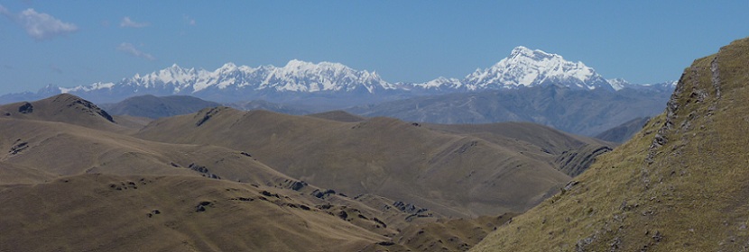
The central Andean plateau is one of the most imposing topographic features on Earth’s surface and influences climate on regional and global scales. Despite its significance, the geodynamic processes responsible for plateau formation and evolution remain poorly understood. Current end-member geodynamic models for Andean plateau formation predict one of the following modes of plateau evolution: (1) slow-and-steady rise of the plateau commensurate with crustal shortening, or (2) rapid rise of the plateau associated with removal of dense lower lithosphere following significant crustal shortening. The controversy between these two models persists, in part, because of lack of overlap in space and time between fundamental data sets that are used to interpret temporal changes in climate, elevation, lithospheric thickness and composition, and magnitude of deformation. In addition, some data sets appear to conflict due to observational uncertainties and/or ambiguities in data interpretation. A systematic and integrative approach to data collection, analysis, and interpretation is needed to resolve the geodynamics associated with elevation gain in the central Andes.
CAUGHT is a multidisciplinary effort to test these end-member geodynamic models for the surface uplift, deformation history, and lithospheric evolution of the central Andes of southern Bolivia and Peru. This effort entails: (i) evaluation of the current and past lithospheric structure in the central Andean plateau to determine crustal density variations and the depth of the lithosphere-asthenosphere boundary; (ii) reconstruction of the deformation history of the plateau to evaluate the age, magnitude, and rate of shortening, and thereby constrain the temporal and spatial crustal thickening history; (iii) compilation and critical analyses of paleoclimate and paleoaltimetry proxies to determine the constraints (±uncertainties) they place on the surface uplift history. Multiple data sets will be collected and tested against the two end-member modes for plateau uplift. Approaches we will use include: (1) imaging lithospheric structure from deployment of a broadband seismometer array and passive source seismology, (2) quantifying temporal variations in mantle input and crustal thickness into the Altiplano using igneous petrology and geochemistry (3) quantifying kinematic and shortening history from balanced cross-sections, sedimentary basin analysis, and detrital and bedrock thermochronology, (4) expanding and refining reconstructions of the plateau elevation and climate history from stable isotope geochemistry, and (5) modeling past climates on regional scales to evaluate factors that influence paleoclimate and paleoaltimetry proxies. Coordinated group field campaigns and workshops will bring these data sets together to reconstruct the evolution of the Andean plateau and adjacent fold-and-thrust belt to identify and resolve internal inconsistencies among the various datasets. Together, these observables will provide an unparalleled comprehensive investigation of the evolution of continental plateaus. Each data set requires the expertise of different disciplines, and no one data set can fully explain the development of the plateau independently, making this an ideal collaborative effort for Continental Dynamics.
Broader Impacts
- Inclusion of undergraduate and graduate student training and education
- Development of early career scientists
- Participation of under represented groups
- International collaborations. The P.I.s and students will collaborate with Bolivian and Peruvian scientists at academic institutions, the petroleum industry, and government
- Broader societal benefits include development of project-related mini scientific documentaries, or “film bites,” freely distributed over the web for K-12 teachers in the U.S.
- All preliminary data and computer programs will be available to the broader scientific community through this web site